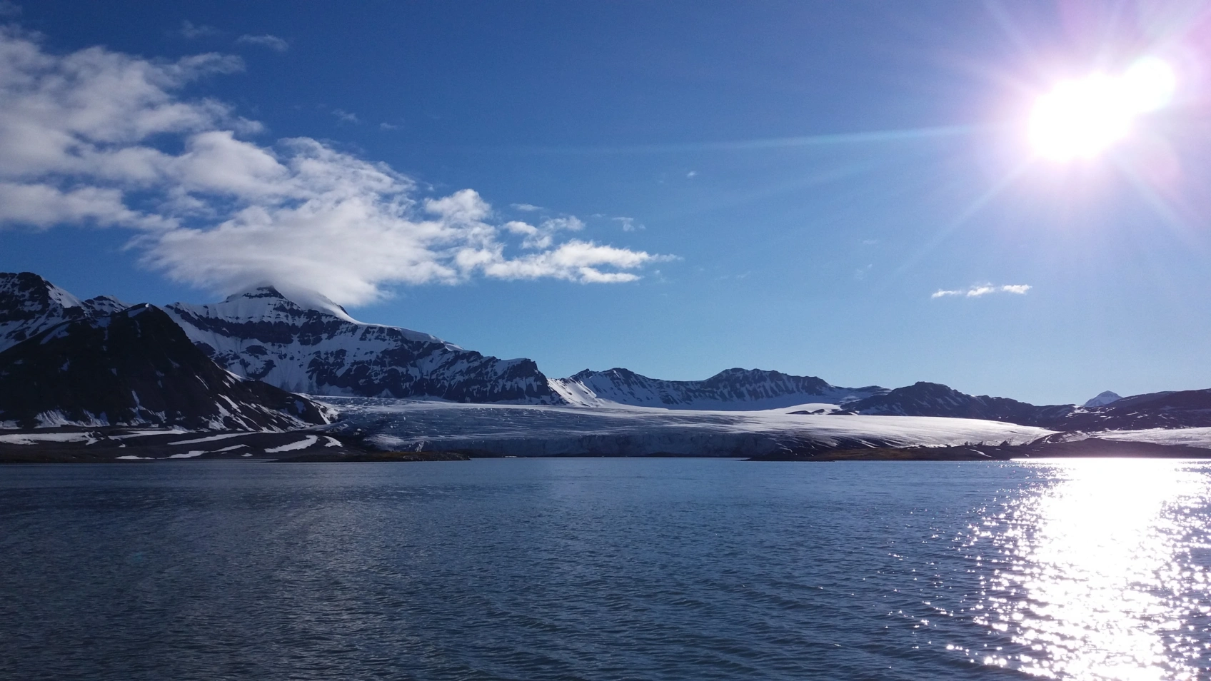
10,000 years of avalanches hidden at the bottom of the lake
Read moreFind an Expert
Our researchers are employed either at NORCE, UiB, the Nansen Center or the Institute of Marine Research. The researchers work together across various scientific disciplines. Find researchers with backgrounds in meteorology, oceanography, geology, geophysics, biology and mathematics, among others.
Projects
Researchers at Bjerknes are involved in several projects, both nationally and internationally. The projects are owned by the partner institutions, with the exception of our strategic projects.
Publications
Researchers at the Bjerknes Center publish more than 200 scientific articles each year.
Calendar
Se alle27.03.26
Ledergruppemøte Bjerknessenteret

08.04.26
Hazards meeting series
Hazards Discussion Meeting Series 2026 – Your science and society What? Science talk on a paper or project, followed by an open discussion on how the presented science can reach “society”. In the open discussion we will address the target “society” audience for the paper/project, how the main outcomes can be best communicated, and who at BCCR can help. Who can attend? Open to all BCCR. When? Every second Wednesday of the month, 11–12h, in Bjerknes Meeting Room (3rd floor). 8 April Ingrid Sætersdal (NORCE) Fjords / ecosystems / eDNA Paper 13 May Mats Venning (NORCE) Climate Services Paper 10 June Victoria Miles (NSERC) Urban climate hazards FTI
08.04.26
Workshop on Self-Organizing Maps
Dear all, Mark Seefeldt from the University of Colorado - Boulder who is in Bergen for the spring as a visiting Fulbright Scholar kindly invites you to a workshop or short tutorial on Self-Organising Maps. A brief description of which is below, and the key details are: When: Wednesday, April 8, 12:30-1:45 PM Where: BCCR - Undervisningsrom 4020 Please send an email to Mark Seefeldt (mark.seefeldt@colorado.edu) if you would like to download the slides prior to the workshop. Or if you have any questions. Kind regards, Priscilla Workshop Description The method of Self-organizing maps (SOMs) is an artificial neural network data analysis technique that objectively stratifies large volumes of data into a smaller number of recurring patterns on a physically meaningful basis. SOMs have been used for the past 20+ years in the atmospheric and climate sciences identifying patterns in sea-level pressure, winds, relative humidity, and vertical profiles of potential temperature, to name a few applications. This workshop will provide an introduction to the application of SOMs in atmospheric and climate sciences by providing an overview of SOMs, a description of what is done during SOM training, and reviewing two common methods to create SOMs and corresponding analyses. Throughout the presentation there will be a variety examples provided showing the different ways in which SOMs have been applied to atmospheric and climate sciences.
Our Research Groups
Cross-Cutting Activities
Learn About Climate Science
Se alleNews
Se alle
24.03.26
Building Bergen’s climate hazard stories
In Bergen, climate risk is shaped by mountains, fjords, and urban forms. Researchers are now translating advanced climate data into local hazard stories for the city’s districts.

22.03.26
Less Sea Ice in the Arctic
This year's sea ice maximum is approaching record low levels – an accelerating trend, according to researchers.

19.03.26
The climate festival “Varmere Våtere Villere" in pictures
There were many Bjerknes researchers in action during the climate festival. Here are some highlights from three days in Bergen.


