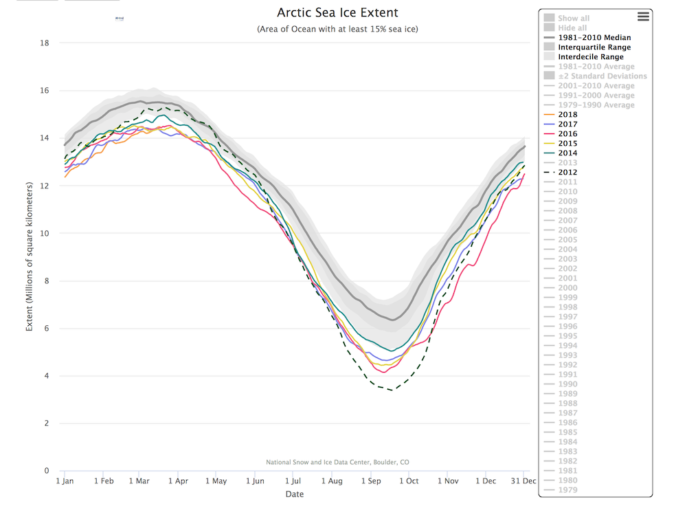
In a new scientific paper Ingrid H. Onarheim and colleagues at the Bjerknes Centre describes where the ice loss appears, and the different months during the year it takes place in these different regions. Their results show that Arctic sea ice loss increasingly happens during winter. This year is no exception.
– This winter we had a new January record, the same for February. But the last weeks have been cold enough to form more sea ice, says Ingrid Onarheim.
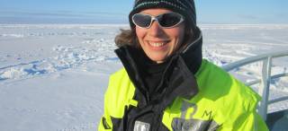
She is a researcher at the University of Bergen and the Bjerknes Centre, and accomplished her PhD last year on how Arctic sea ice loss can be better described and predicted years in advance.
In this new paper Onarheim has together with the two Bjerknes-professors Tor Eldevik og Lars H. Smedsrud and the American sea ice scientists Julienne Stroeve, professor at University College London, analyzed how the sea ice loss is distributed between the Arctic seas during the year. The results show two new and general patterns where the ice melts during summer in the north, and there is less formation during winter in the seas further south.
Ice and solar forcing
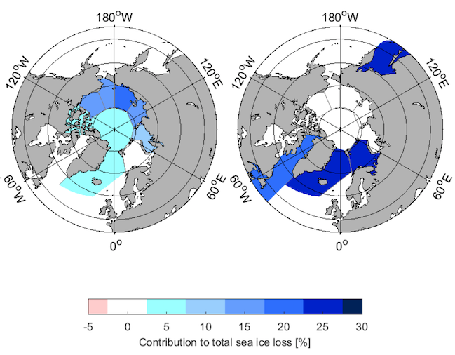
By studying the loss of sea ice over the last 67 years across the Northern Hemisphere, Onarheim and her colleagues have found one particular pattern for summer loss, and one very different for loss of sea ice during winter. The observations are from satellites back to 1979, and from other sources like photographs from area surveys back to 1950.
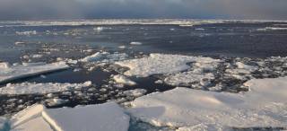
During summer the sea ice re-draws northwards all across the Northern Hemisphere, and large areas of the Arctic Ocean are now open water in late summer. The sea ice is then almost gone from areas like the Barents Sea. But – during autumn when the sun sets below the horizon most of the Arctic Ocean freezes rapidly over – apart from the Barents Sea.
– It was quite some surprise that the sea ice re-forms so quickly during autumn. We really had expected a symmetric response due to global warming. That would be a similar earlier loss of ice during spring and a later formation during autumn. But this is not what the data shows – when the solar heating stops in November the re-freezing is surprisingly fast, says Lars H. Smedsrud, professor in polar oceanography at the Bjerknes Centre and University of Bergen.
Barents Sea – the odd case
The Barents Sea is different. Here, there is almost no summer sea ice, but it dominates the Arctic winter sea ice loss. Also the variability in the entire Arctic winter sea ice cover is dominated by the Barents Sea. There is some additional winter variability in the Okhotsk Sea, the Greenland Sea, and an area directly north of Svalbard called Whalers Bay.
One important cause of the Barents Sea ice winter loss is the inflow of warm Atlantic Water at the far end of the Gulf Stream (North Atlantic Current). This flow varies but has both been strong and warming over the last decades.
– Towards 2050 we estimate that the Barents Sea ice will be totally gone also during winter, and that the areas loosing summer ice today will appear like today’s Barents Sea says Ingrid Onarheim.
This means that the Beaufort Sea, the Chukchi Sea, the East Siberian Sea and the Laptev Sea all will start losing sea ice during winter.
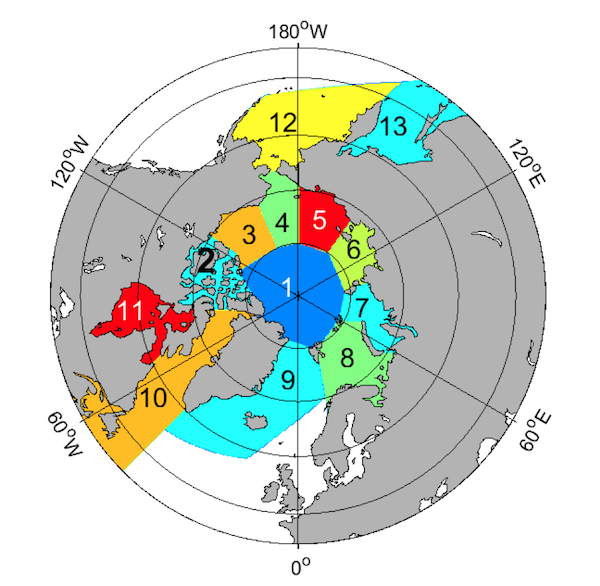
1 Det sentrale Arktis, 2 Det kanadiske polararkipelet, 3 Beauforthavet, 4 Tsjuktsjerhavet, 5 Øst-Sibirhavet, 6 Laptevhavet, 7 Karahavet, 8 Barentshavet, 9 Grønlandhavet, 10 Baffinbukta/ St.Lawrencebukta, 11 Hudsonbukta, 12 Beringhavet, 13 Okhotskhavet. Figur: Ingrid Onarheim
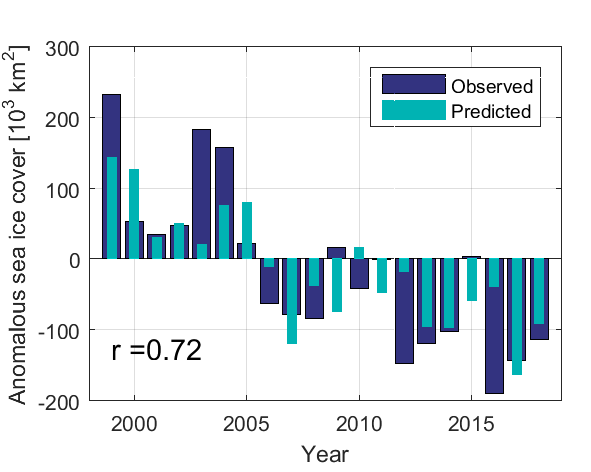
Sea ice prediction hit the target
The prediction for the mean winter Barents Sea ice cover was issued in January earlier this year; still less than «normal» - but more that the two last years. This prediction now appears to hit the target nicely.
– The sea ice may still grow for a few weeks more, but the prediction holds Onarheim says.
The seasonal prediction is based on the volume of inflowing Atlantic Water into the Barents Sea between Norway and the small Bear Island to the north. The big unknown is the wind though. Winds may push more sea ice southwards into the Barents from the Arctic, or northwards out of the Barents domain.
Reference:
Onarheim, I.H., T. Eldevik, L.H. Smedsrud, and J.C. Stroeve, 0: Seasonal and regional manifestation of Arctic sea ice loss. J. Climate, 0, https://doi.org/10.1175/JCLI-D-17-0427.1