Written by Jan Magne Cederstrøm from the Bjerknes Centre and the Department of Earth Science, UiB.
When the glaciers erode the landscape, sand and sediments gets frozen into the ice. When the glacier later calves into the ocean, these sediments will be a part of the icebergs until the ice melts and the sediments falls to the ocean floor.
These ice-transported sediments are often called ice rafted debris (IRD) and we can use the presence and quantity of them to determine how past glaciers have behaved. But to locate and quantify the number of sand grains in a long sediment core is a time-consuming process, something we tried to contribute to with this project.
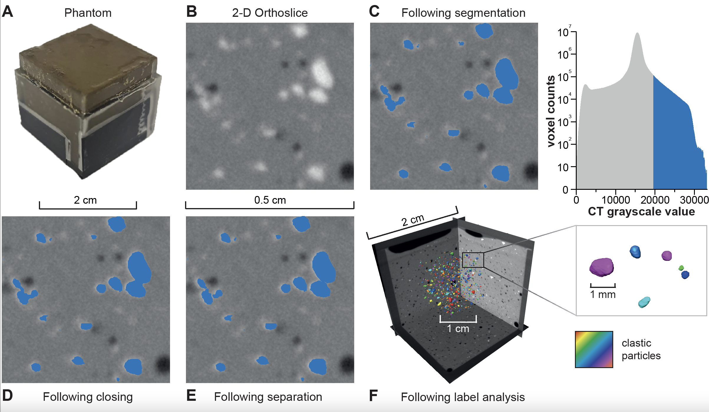
In our latest article we use computed tomography (CT), maybe best known from a visit to the hospital or a hospital-show on TV, which gives us the possibility to X-ray scan up to 1.5 m long sediment cores with a resolution as good as 20 µm. Then it is possible to use the density-difference between the sand grains and the surrounding clay to isolate and quantify the number of sand grains.

The method was first tested by using small boxes filled with clay and a known number of sand grains, before using it on sediment cores whit existing manual IRD-counts done with microscope to see the difference between the two methods. Our project showed that it was possible to produce just as good results, but with a higher count-frequency than manual counting allows.
The usage of the CT-scanner also gave us the ability to visually analyse the sand grains in-situ to e.g. see if they are deposited in a layer, if there is a grading of the sand or if some organism has been digging in the sediments and moved the grains (bioturbation).
Reference
Cederstrøm, J.M., van der Bilt, W.G., Støren, E.W. and Rutledal, S., 2021. Semi‐automatic Ice Rafted Debris quantification with Computed Tomography. Paleoceanography and Paleoclimatology, p.e2021PA004293.
https://agupubs.onlinelibrary.wiley.com/doi/full/10.1029/2021PA004293

