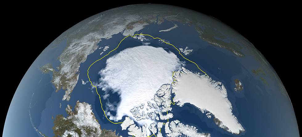
If you had been in a plane over the Arctic Ocean right now, you would have seen more open waters below you than normal. September is the month with least sea ice, as the summer has ended and fall has not yet got a firm grip. This year there is also less ice than in an average September.
If this year were to follow the pattern from the last decades, little sea ice would be a reason to prepare for a cold winter. Many summers and falls with little sea ice have been followed by cold winter months in Europe, Siberia and North America. But research suggests our personal experiences are of limited value.

“Little sea ice does not cause cold winters”, says Peter Siew.
Siew has led a recently published study looking at the connection between sea ice and the tracks of cyclones over the North Atlantic. His work was a part of his PhD at the Bjerknes Centre and the University of Bergen.
The results indicate that the sea ice cover in the Arctic has no influence on European winters. Little sea ice now is not likely to make January colder. Any covariation between sea ice and winter weather do not occur because the ice affects the weather, but because both are affected by the same conditions in the atmosphere in fall.
Sea ice and winter temperatures have covaried
The Arctic heats up faster than any other part of the world. During the last years, much research has been focused on possible consequences for the weather in North America, Europe and Siberia. Studies of long-term changes have also highlighted interannual variations in weather and sea ice cover.
Observations from the last forty years may give the impression that there is a connection between the sea ice extent in the Arctic and winter storm tracks over the North Atlantic. Little sea ice in fall has been followed by winters when low pressure systems have tended to follow southerly tracks towards Southern and Central Europe. In Northern Europe, the weather has been cold and clear for weeks at a time. Oppositely, falls with more ice than normal has been followed by mild and wet winters in the north, as low after low has marched into the Norwegian Sea.
If this was always the case, it should be possible to use the ice conditions in fall to predict the winter. Such connections suggest the possibility for seasonal forecasts several months ahead, useful whether one is trading energy, filling a warehouse or allocating resources for road maintenance.

But, to use an observed link to predict future weather, the mechanisms behind it must be understood. To get there, the links must be established and certain.
Camille Li, a professor at the Bjerknes Centre and the University of Bergen, and a specialist on storm tracks, has also participated in the study of sea ice and European winters.
“Observations cannot be wrong”, she says. “But our interpretation of them may be.”
The fact that cold winters have followed seasons with little ice, does not mean that the ice conditions have made the winters cold.
Little ice this year
As this year’s summer melt season has come to an end, there is little – though not extremely little – sea ice in the Arctic. The American National Snow & Ice Data Center estimates that the sea ice extent will be the twelfth lowest registered. Compared to other years in the last decade, 2021 is the year with the most ice. Compared to 1981–2010, there is only three fourths as much ice this year as normal.
The Barents Sea and the Kara Sea, used in this study, are normally ice free in summer. But little ice in the rest of the Arctic may lead to less formation of ice in the coming months, also in these regions.
With less ice and more open waters, more heat and moisture are transferred from the sea to the air above. No one doubts that there is an effect. The question is whether the effect is strong enough to change the weather several months later as far south as Europe.
Climate models do not support a connection
To explore what goes on when separate climate phenomena interact – as in the case of sea ice cover and weather – scientists use climate models. In the models, conditions in the ocean and the atmosphere develop according to the laws of physics. If the result is in accordance with what has been observed, one can normally assume that the models represent the real world.
In this case, one thing has frustrated many climate scientists. The connection between sea ice and winter weather, observed in the real world the last forty years, has been impossible to identify in the climate models. In the models, the ice and the weather vary independently.
The ice cover and the winter weather has indubitably been real. That has made many researchers wonder whether there is something wrong in the way climate models handle this problem.
The answer lies in the time. What you end up seeing, depends on which decades you consider.
Forty years are not enough
Since the end of the 1970s, satellites have surveilled the surface of the Earth. This has revolutionized the knowledge of ice conditions and weather. It is tempting to restrict study periods to these years.
“Everybody understands that one year is too little to say anything about climate”, says Camille Li. “But it was thought that forty years would be enough.”
It was not.
When the researchers went further back in time, extending the period from forty to a hundred years, the picture changed. The connection they had observed between the Arctic sea ice and European storm tracks, disappeared. The last forty years proved to be an exception.
«I do not mean to say that forty years are too short for any study», Camille Li emphasizes.
If you want to calculate the mean temperature of the Earth, forty years are enough. If you want to understand complicated mechanisms in the climate system, like the connection between the Arctic sea ice cover in fall and the weather in a different part of the world, you need longer records.
In an individual year or a few decades, it is too difficult to separate the effect of various phenomena on the weather. Small deviations from the observed state could have produced outcomes that were different from that observed during the last forty years.
One of Peter Siew’s earlier studies demonstrate the reason for this. To produce weather forecasts, the same computer models are run many times with tiny changes in the initial conditions. This makes it possible to estimate the probability of developments in specific directions. The reality observed can be compared to a single one of these model simulations. Things could have developed in other directions than they in fact did.
A hundred years gave different results
When Peter Siew and his colleagues went from forty to a hundred years, the problem thought to exist in the climate models, disappeared. Seen over a century, neither the observations or the models indicate any link between Arctic sea ice in fall and winter weather in North America and Eurasia.
Other conditions in the atmosphere and the ocean were also the same. Thus, they could reject the idea that the models were wrong. That the link between sea ice and winter weather is unstable, has been showed previously, so this is the most important contribution from the new study.
Where did the association between ice and weather the last forty years come from? The link that disappears when considering the last century, but which seems to have given us so many cold winters in the last decades?
“A coincidence”, says Peter Siew.
He refers to chaotic variations in the weather. In most decades ice and weather varies independently, in the last forty they accidentally followed the same pattern.
Still, his work suggests that it may not have been purely by accident.
Blocking high behind both reduced ice cover and cold winters
In some years, strong high pressure regions form over the Ural Mountains. The highs can be stable and remain there for a long time, blowing mild air from the south towards the ice in the Barents and Kara Seas. The mild weather means that less ice forms in fall. In November, the month considered in this study, there will be little ice.
Peter Siew and his colleagues support a theory suggesting that such highs over the Ural are also the cradle of cold winters. Waves in the air above the high can influence the stratosphere, more than ten kilometers above the ground. In the stratosphere, a strong vortex encircles the North pole.

Disturbing the vortex may affect the storm tracks farther south. When the vortex weakens, the winter weather will often remain cold for a long time.
Such mechanisms make it possible to predict the weather for the coming month or months, though not as detailed as in forecasts for the coming week. Monthly and seasonal predictions state the probability of wetter or drier, and warmer or colder conditions than normal.
Even then there are reasons to be careful. Stefan Sobolowski is a researcher at the Bjerknes Centre and NORCE, and has contributed to the new study. Through the center Climate Futures he also takes part in the development of seasonal predictions for practical use.
“I would neither use the sea ice, nor the Ural high to predict the winter weather”, he says.
A range of winters to choose between
A blocking high over the Urals can be a notice but cannot explain more than a small part of the variations in the winter weather. Other phenomena can disturb the signals to and from the stratosphere.
Instead of statistics and simple associations, seasonal predictions are made using computer models that calculate the developing weather from the laws of physics.
As in weather forecasting, the models are run many times to allow probability estimates for various outcomes. This produces a set of possible winter seasons. If many of these are cold, one can assume that the coming winter likely will be so.
September is in either case too early. Stefan Sobolowski will not even make a guess of whether this winter will be cold, mild, dry, wet or snowy.
“Do not go and buy an extra thick duvet yet”, he says.
Perhaps in November
Even though the current sea ice does not influence our winter weather, other such phenomena may make the weather more predictable. Stefan Sobolowski says there is reason to believe there are other, unknown links, and finding them could improve future seasonal predictions.
Only in January will we surely know what the weather in January will be like. But he hopes to give us a prediction later this fall.
“Ask me again late in November!”
References
P. Y. F. Siew, C. Li, M. Ting, S. P. Sobolowski, Y. Wu, X. Chen, North Atlantic Oscillation in winter is largely insensitive to autumn Barents-Kara sea ice variability. Sci. Adv. 7, eabg4893 (2021)
https://advances.sciencemag.org/content/7/31/eabg4893
Siew, P. Y. F., Li, C., Sobolowski, S. P., and King, M. P.: Intermittency of Arctic–mid-latitude teleconnections: stratospheric pathway between autumn sea ice and the winter North Atlantic Oscillation, Weather Clim. Dynam., 1, 261–275, https://doi.org/10.5194/wcd-1-261-2020, 2020.
Kolstad, E. W., & Screen, J. A. (2019). Nonstationary relationship between autumn Arctic sea ice and the winter North Atlantic oscillation. Geophysical Research Letters, 46, 7583– 7591. https://doi.org/10.1029/2019GL083059