Written by Carl Regnéll from the Bjerknes Centre and the Department of Earth Scicence at the University of Bergen.
The early Holocene – the period following major global deglaciation at the end of the last ice age – is the most recent period in which rapid ice sheet retreat and sea-level rise took place under climate conditions comparable to today. However, the course of the final deglaciation and the location of the last remnants of the Scandinavian Ice Sheet are debated.
In our new article, we have analysed high resolution terrain models (LiDAR-data) from a large area in northern Sweden and mapped glacial landforms, in order to trace and date the final deglaciation of the Scandinavian Ice Sheet.

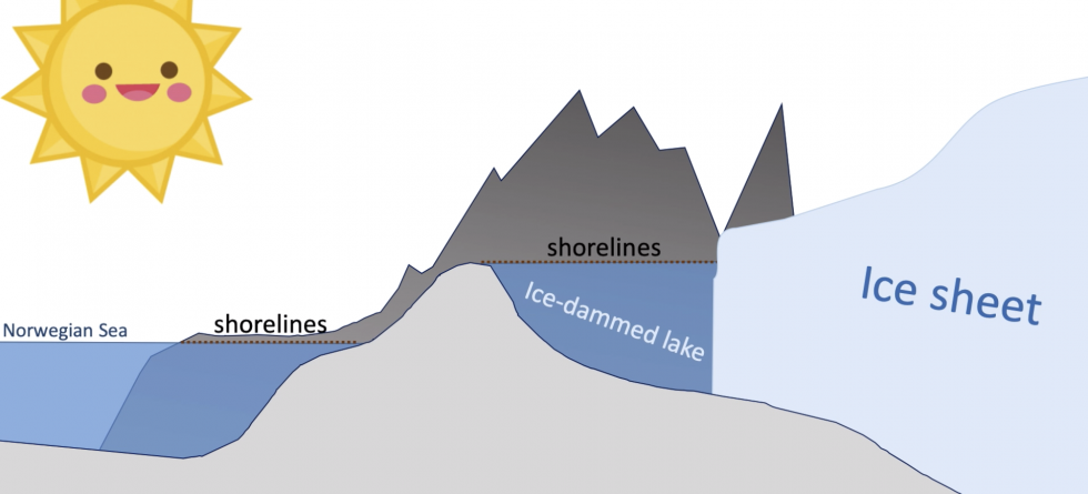
We discovered series of ancient shorelines located high above present-day lakes and valley floors. These shorelines demonstrate that large lakes, several tens of kilometers long, were dammed between the main water divide to the west and the retreating ice sheet margin to the east. The implication of our findings is that the last remnants of the Scandinavian Ice Sheet were located in the lowland east of the mountain range, not in the high mountains as previously assumed.

Eventually the ice sheet became too small to dam these large lakes and the ice-dams burst, causing these large water bodies to drain catastrophically under the ice and further east-ward. These huge flooding events produced large deposits and extensive erosive features along the river valleys to the east. These features are particulary striking along the Pite River Valley where we found traces of a catastrophic glacial lake outburst flood as high as 50 m above the present-day river level.
Based on cross-cutting relations to dated raised shorelines developed in the early Holocene Ancylus Lake that occupied the Baltic Sea Basin at the time, we conclude that the flood and thus the final phase of deglaciation took place within the time interval 10.3-9.9 cal ka BP, that is some 1600-1200 years after the end of the ice age.

This animation shows how the shorelines can be dated.
Reference
Regnéll, C., Mangerud, J., & Svendsen, J. I. (2019). Tracing the last remnants of the Scandinavian Ice Sheet: Ice-dammed lakes and a catastrophic outburst flood in northern Sweden. Quaternary Science Reviews, 221, 105862. https://doi.org/10.1016/j.quascirev.2019.105862

