"Why doesn't it rain more?"
Climate change enhances extreme rains more than the ordinary drizzle. New research shows that frontal rain increases the most, and illustrates why extreme rains caused by other phenomena are not equally affected.
Publisert 20. August 2025
Written by Ellen Viste
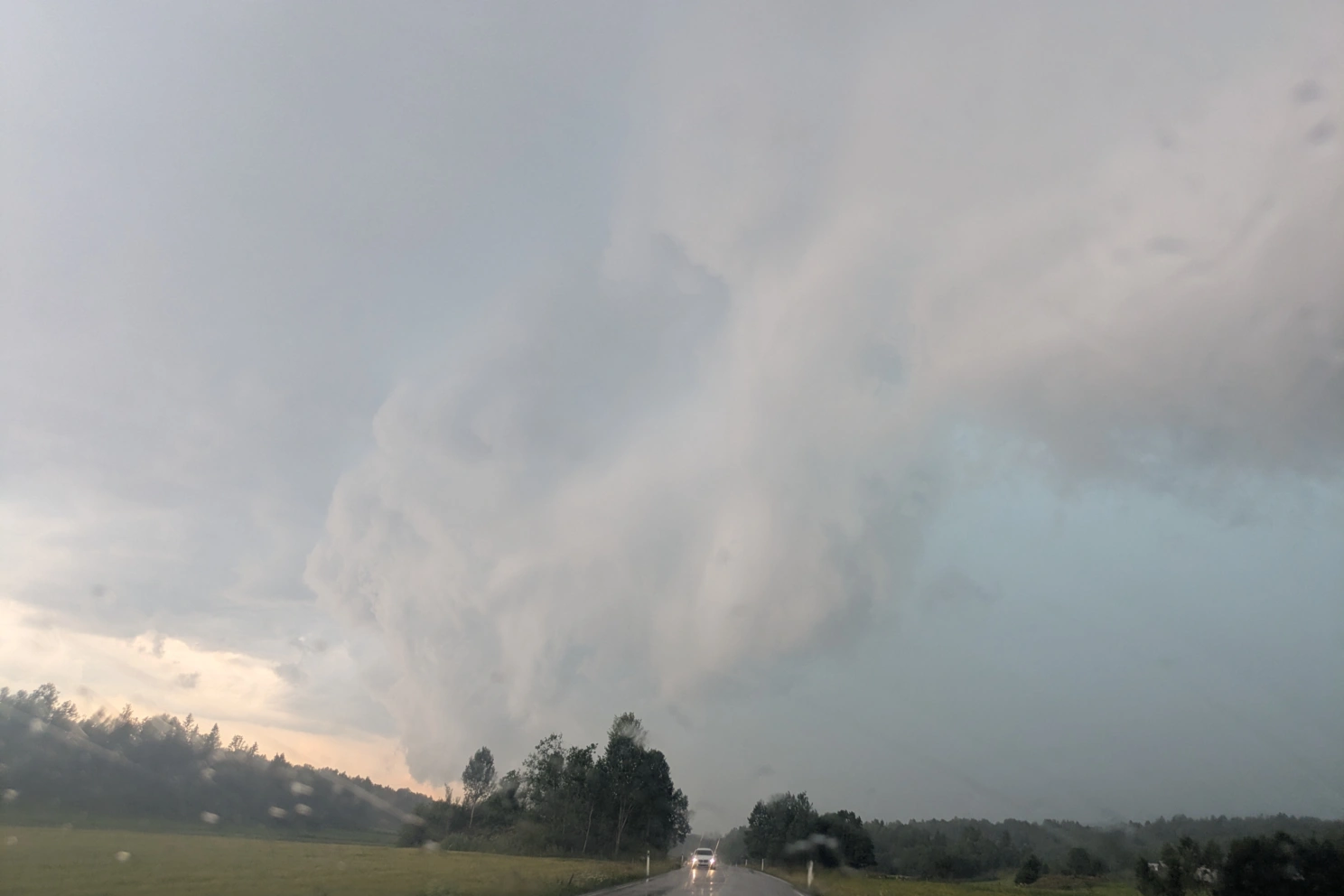
Heading for the rain. Photo: Kjersti Konstali
"We had to stop the car, because we didn't see the road," says Kjersti Konstali. "It was pouring down, with hail, and lightning strikes every three seconds."
The rain researcher from the Bjerknes Centre and the Geophysical Institute at the University of Bergen recalls a car trip between the Norwegian cities of Tønsberg and Drammen in the middle of July this year.
In a recent study she and her colleagues have looked into the mechanisms making the heaviest rainfall not just more extreme, but more extreme relative to not quite as extreme rainfall.

Kjersti Konstali is a meteorologist studying weather types that cause extreme precipitation. Photo: Ellen Viste
The most extreme increases most extremely
Higher air temperature makes it rain more. That extreme precipitation increases more with temperature than weaker precipitation, is well-known. Periods of extreme precipitation get wetter than the mean precipitation over days and years, in relative as well as total amounts.
But looking further, at the extremes of the extremes, made Kjersti Konstali and her colleagues wonder. Not all extreme precipitation is affected equally by climate change. The most extreme rains are enhanced more than the less extreme extremes.
What could be behind this difference?
The researchers looked at various weather types associated with rainfall: extratropical cyclones, weather fronts and atmospheric rivers, as well as combinations of these phenomena. Using simulations from a climate model, they studied the weather during six-hourly periods of extreme precipitation in the years 1950 to 2100.
"Extreme precipitation connected to fronts increases significantly," says Kjersti Konstali. "I was surprised to see how clear the difference between the different types of weather were."
Heavy rain that occurs without any fronts nearby, will not cause more precipitation in the future, in some parts of the world rather less.
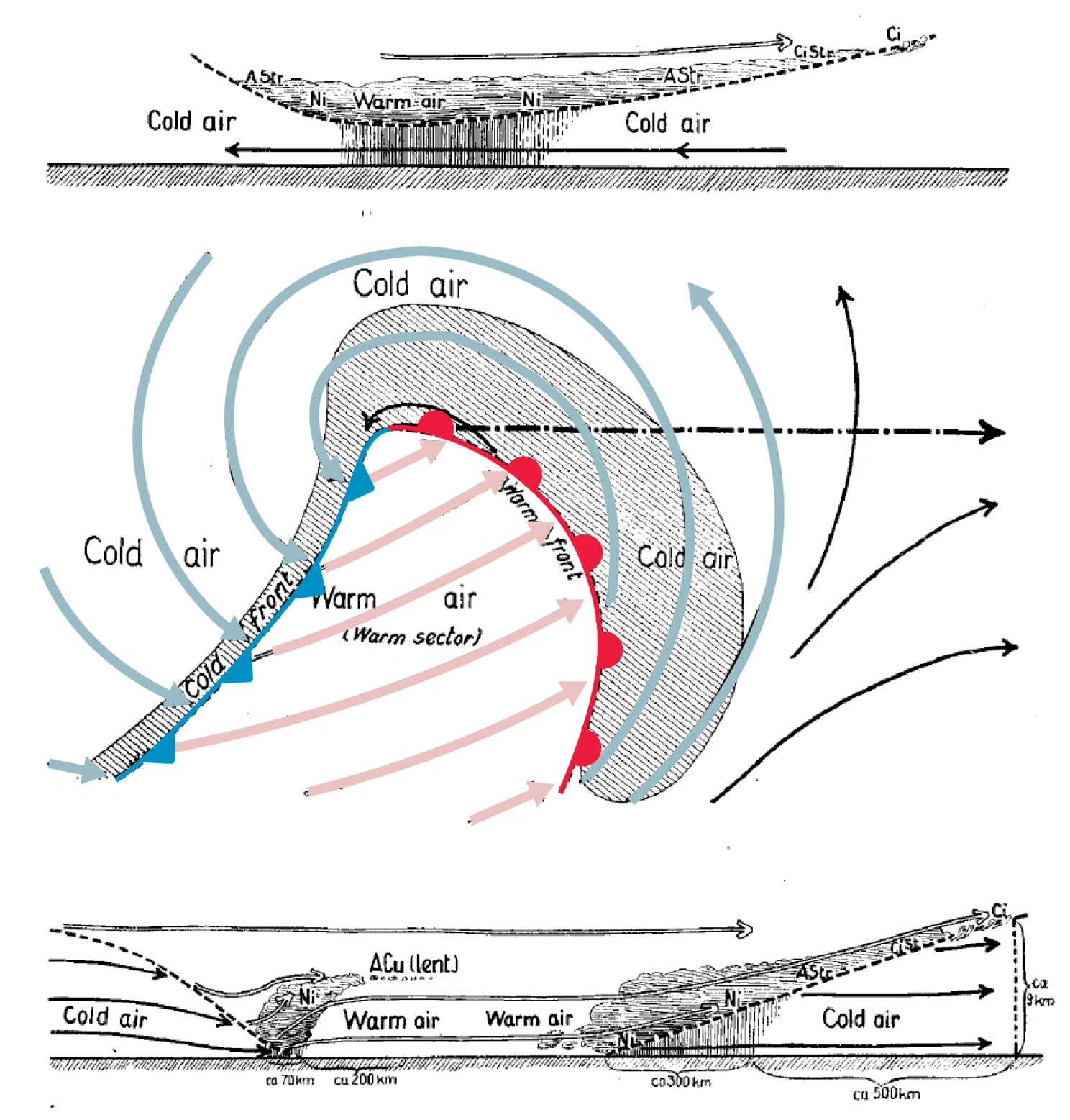
An extratropical cyclone and its fronts, as Jacob Bjerknes and Halvor Solberg pictured them in 1922. Bjerknes and Solberg were among the main contributors to the Bergen school of meteorology, a direction within weather forecasting developed in Bergen during the 1920s. An important component was the Norwegian cyclone model, a theory describing how lows and fronts develop. Colors have been added to mark the separation between warm (red) and cold (blue) air. Source: Bjerknes & Solberg, 1922
Moist air is not enough
Increasing temperature has to affect precipitation.
For every degree the air temperature increases, saturated air will contain seven percent more water vapor. This is a simple law of nature, letting the air shed seven percent more water. In theory we can expect seven percent more precipitation when it rains.
When it rains. That is, if the available water vapor condenses into water and falls down.
For raindrops to be formed, having moisture in the air is only a first step. The air must also rise and get sufficiently cooled for the water vapor to condense into water. Such ascent occurs in cyclones and fronts or as the air approaches mountains.
The final result depends on where lows and fronts are located, how strong they are and whether the rising air gets sufficiently cooled. In this way, the weather systems moderate the simple law of nature calling for seven percent more precipitation.
No simple law of nature can tell how this will turn out in a warmer world.
Less rain than the temperature indicates
"Why doesn't it rain more?"
Kjersti Konstali asks rhetorically. Extreme precipitation that occurs in the absence of fronts, increases less than the seven percent per degree predicted by the warming of the air, perhaps only a few percent or not at all.
"Fronts are the only weather type that can fully use the extra moisture," she replies to her own question. "The other weather types don't manage to squeeze the water out of the air."
Disregarding the kind of weather, warmer air will contain more water vapor. But the ascent occurring in extratropical cyclones and atmospheric rivers, is not strengthened enough to transform all their extra vapor into water. Only in fronts did Kjersti Konstali and her colleagues find such an increased efficiency.
Fronts are enhanced by their own rain
Fronts are sharp separations between warm and cold air masses. Where warm and cold air meet, the warm air rises above the cold, and clouds and precipitation form.
As water vapor condenses into liquid water, heat is released. The air in and around the clouds get warmer because droplets form. This sharpens the temperature gradient between the warm and cold side of the front – the front's defining characteristic.
The air around the front is in constant motion, and in contrast to the other weather phenomena considered, all extra available water vapor is transformed into water.
Fronts are connected to low pressure systems. So far, there is no consensus as to whether climate change will make extratropical cyclones more or less intense. But strong fronts get stronger as it rains, and stronger fronts lead to even more rain. The effect is self-reinforcing.
Extreme weather with fronts already generates the strongest precipitation in extratropical regions. That frontal precipitation increases the most with temperature, implies that the most extreme precipitation is most strongly affected by global warming.
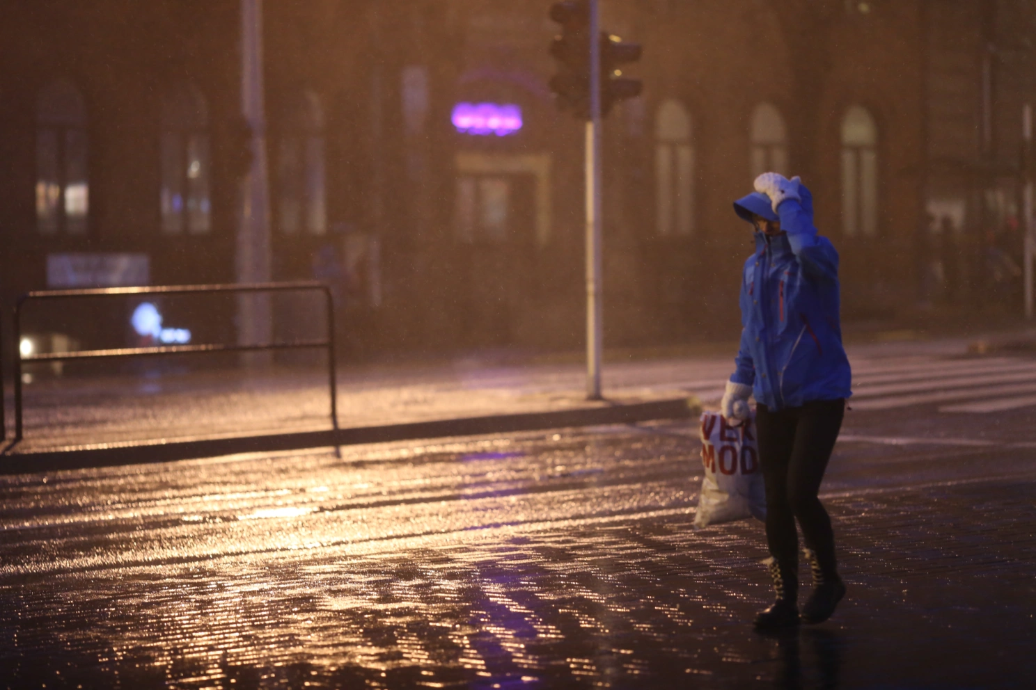
Fall and winter is the high season for wet weather. Photo: Jerry Tjiputra
High season coming up
The wettest days occur when cyclones march in with fronts and an atmospheric river – a powerful troika now and in the future. But of the three, the front causes the largest increase.
Though fall and winter is the high season for prolonged and extensive rain, even apparently local summer showers may be driven by fronts.
The thunderstorm Kjerstil Konstali experienced on her drive a Wednesday afternoon in July, was no local phenomenon. Over large parts of Southern Norway the air was warm and unstable. When a weather front gave it a lift, the sky erupted, not just in Southern and Eastern Norway, but in the western part of the country as well as over Skagerrak and Southern Sweden.
"The car is the safest place to sit in a thunderstorm," says rain researcher Konstali. "But we had to stop."
This time the rains were intense, but short-lived. After five or ten minutes the worst had passed, and they could start the car and head back on the road.
References
Atmospheric fronts drive future changes in extratropical extreme precipitation